Embedded Files

The Best of Death Valley
March 3rd-5th 2018
Join us for this is a 3 day Adventure Ride around Death Valley.
Dual Sport and Adventure Bikes

Check out my video description of the ride
The ride will begin and end in Ridgecrest, CA
About the ride:
This is a 3 day ride to explore the best of the back parts of Death Valley.
We will spend each night in a different hotel and the ride will include a support van to carry your overnight gear.
The ride will have options of routes to take depending on the level of difficulty that you select and the weather conditions.
Riding begins Saturday morning March 3rd, 2018
Recommendation: You should arrive Friday night in Ridgecrest
Signup info:
Sorry ride is closed
Ride Saturday Day1
Starting from Ridgecrest we will travel through the Pinnacles, over Mengel Pass, visit the Charlie Manson ruins. We will pass through the Badwater Basin, the lowest point in the Unites States and take a lap through Artist Drive. We have lunch and gas at Furnace Creek and after lunch well head you Echo Canyon and across to Beatty, NV to stay at the Death Valley Inn.

Day1 ride map
Ride Sunday Day2
Starting from Beatty, we will ride down Titus Canyon and over to Scotty’s Castle for a lunch stop. Then it’s an option to visit Ubehebe Crater then past the old Sulfur Mine and Crankshaft Junction. Then it’s over the mountains to Big Pine for the evening in the Bristlecone Motel.
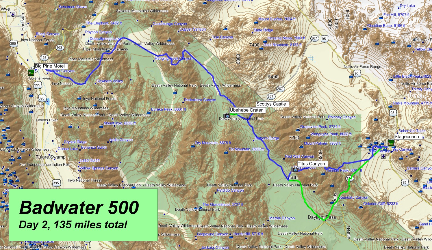
Ride Map Day2
Ride Monday Day3
Starting from Big Pine, we will travel into the Inyo Mountains in the north, then the Sailine Valley, home of the “Borax Company” and Nelson Range in the south, then it’s into Panamint Springs for lunch. After lunch it’s through the Panamint Valley and back to Ridgecrest.
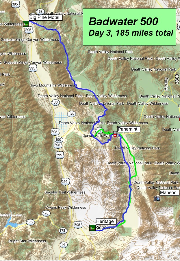
Ride Map Day3
Ride Yoda's


Yoda gpsKevin Yoda Gil
Questions about this ride contact:
Yoda gpsKevin: kevin@gpskevinadventurerides.com
Yoda Gil: gilbusick@gmail.com
How does the ride navigation work?
This is a self-led GPS ride; all riding is on your own. You are responsible for your own riding. You will be given a GPS map file and instructions on how to use your Garmin GPS unit. People will hook up in small groups of less than 6 riders and tend to ride together. You are not encouraged to ride alone. You are responsible for your own riding and yourself.
(see my ride Navigation Video)
Are you right for this ride?
When something goes wrong on a ride, would your riding friends say that you are more likely to need help or more likely to give help? You should be in the more likely to offer help camp. This ride is filled with riders that are more likely to give help, so most of the time the riders never need help. Additionally there is all the normal stuff, come prepared to maintain your bike, fix your bike on the trail, repair flat tires, deal with bad weather and rain and make a joke or two.
How do I make the GPS stuff so easy?
I develop very high quality ride maps custom for our ride. They come from much of what I and others have ridden. I take the best from all my rides and make new ones.
(See my Custom Ride Maps Video)
Note from me, gpsKevin
My goal for this ride is simple, great riding, so you can count on great routes and places to ride.
But in addition: the ride is about discovering new places, meeting new friends, seeing new parts of the Southwest.
Thanks
gpsKevin
Page updated
Report abuse